Ubehebe Crater
We often hear mistakenly that “Ubehebe” means “big basket”, but the Paiute name Ubehebe was first applied to the 5,678 ft. Ubehebe Peak, 24 miles south-west of the crater. How the name Ubehebe became associated with the crater is not known. To the Timbisha Shoshone Indians, the crater has been known as “Tem-pin-tta-Wo’sah”, meaning Coyote’s Basket. Although applying this translation to the word Ubehebe has produced a great deal of confusion, but comparing the crater to a basket is appropriate.
Maar Volcanoes
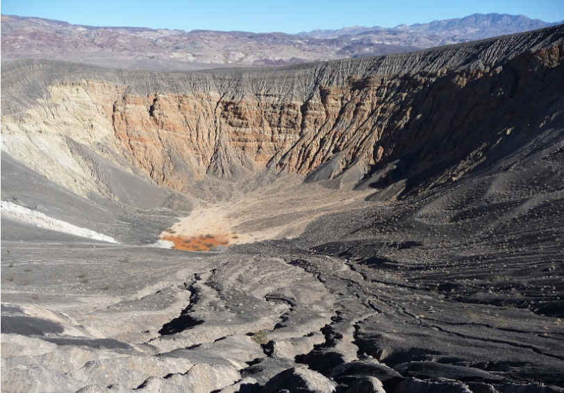
Ubehebe Crater. Photo Courtesy of NPS.
How did these craters originate? They are known as
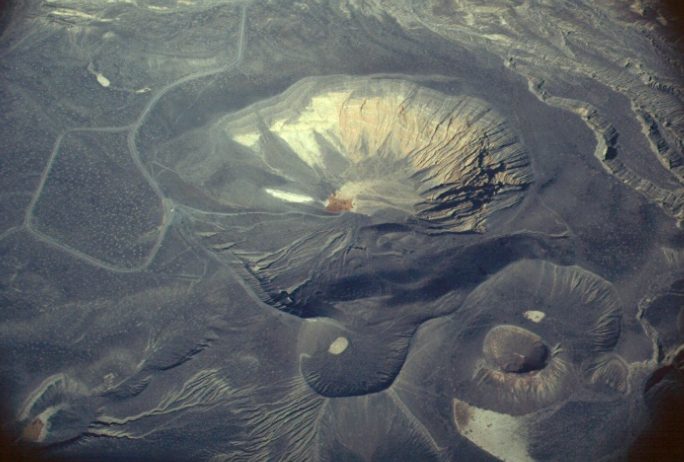
maar volcanoes, created by steam and gas explosions when hot magma rising up from the depths reached groundwater. The intense heat flashed the water into steam which expanded until the pressure was released as a tremendous explosion. The western cluster of Maar volcanoes was the first to form, then the southern cluster, followed by Ubehebe—the largest of them all—about 300 years ago.
Cinder Fields
Cinders from these explosions cover much of the surrounding area. This material is very evident as you drive up the hill to the parking area. Some cinders can even be seen on the dry bed of ancient Lake Rogers on the valley floor north of the craters. The cinders covering most of the area came from Ubehebe and are as much as 150 feet thick at the crater rim, decreasing in depth radially outward from there. The colorful layers in the crater’s eastern wall are fanglomerates through which the explosion occurred. Fanglomerate is an alluvial fan deposit hardened into rock. Sandstone and conglomerate, loosely cemented together by calcite make up this conglomerate and most of the pieces of rock are either volcanic or metamorphic.
Water erosion created the deep gullies that you see on the crater’s east side. The pink and brown mudflat at the bottom of the crater is the site of many short-lived lakes. The crater is about 600 feet deep and half a mile across. The trail to the bottom is easy; however, the trip back up can be exhausting.
The walk around the rim of Ubehebe Crater is about 1 1/2 mile round-trip. This route leads past several smaller craters, including Little Hebe. Please stay on the trail since the crater rim and nearby gullies are composed of very loose material making
Ubehebe Crater and Little Ubehebe. Photo Credit NPS.
them unstable and dangerous.